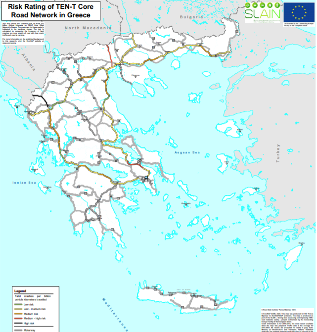
EuroRAP together with RSI Panos Mylonas, delivered to the Greek Ministry of Infrastructure and Transport two maps with the most dangerous roads in Greece. The maps were presented within the framework of the SLAIN project, which aims at enhancing Road Safety at the European Road Network. At these maps, Greek roads risk level is depicted in different colors, based on accidents frequency and quantitative risk assessment. ![]()
![]()
![]()